18 Programming agent AI
18.1 Modelling behaviour
We advance into implementing the behaviour rules, i.e. Artificial Intelligence, of each agent type, particularly traders. Artificial Intelligence (AI) is the simulation of human intelligence in machines that are programmed to think and act like humans (or anything we consider intelligent). In the context of ABM, AI refers to the rules and decision-making processes that govern the behaviour of individual agents within the model.
For our model, based on the conceptual model, we will implement simple behaviour for two agent types:
settlements:- `produce goods according to their size and a productivity term.
- create or destroy traders according to their current size.
traders:- take some goods from their base and deliver them to another settlement,
- which is chosen based on the size of other settlements and the distance between these and the base settlement.
- Traders will then return with goods from that settlement back to the base and restart the cycle.
Implementing this will take us several steps in development (up to step 9).
18.2 Implementing path finding 🤔
Given the importance and potential complexity of these behaviours, let us start by implementing the most fundamental aspect: the traders’ criterion for choosing a destination settlement. We have mentioned “distance”, yet how should traders measure such distance in a heterogeneous terrain?
In the original repository of the Pond Trade model, you will notice an initial attempt to approach this aspect through a simple network implementation, using NetLogo’s links (PondTrade_step07_agent AI v1_links.nlogo). This approach is similar to other ABM and network-based models applied to topics of trade and settlement interactions.
However, as you may know, there can be a significant difference between a straight line measurement (Euclidean distance) and a more complex path cost calculation that uses terrain data. As the Pond Trade model eventually did, we will to “complicate” our design and make a proper “least-cost route” calculation using this as a perfect excuse for learning.
But how should we implement a least-cost path algorithm in NetLogo? We follow our modular philosophy, search and find an implementation of the A* (A-star) algorithm in NetLogo User Community Models.
We get the main fragment of the code from this and adapt it to our purposes, making sure we keep a clear reference to the source as a commentary header:
Note: Try to walk through this code and understand it; but don’t panic if you don’t!
patches-own
[
  isLand
  pathCost

  ;;; path-finding related
  parent-patch ; patch's predecessor
  f ; the value of knowledge plus heuristic cost function f()
  g ; the value of knowledge cost function g()
  h ; the value of heuristic cost function h()
]

...

;;;;;;;;;;;;;;;;;;;;;;;;;;;;;;;;;;;;;;;;;;;;;;;;;;;;;;;;;;;;;;;;;
;;; A* path finding algorithm ;;;;;;;;;;;;;;;;;;;;;;;;;;;;;;;;;;;
;;;;;;;;;;;;;;;;;;;;;;;;;;;;;;;;;;;;;;;;;;;;;;;;;;;;;;;;;;;;;;;;;
; modified from Meghendra Singh's Astardemo1 model in NetLogo User Community Models
; http://ccl.northwestern.edu/netlogo/models/community/Astardemo1
; modified lines/fragments are marked with ";-------------------------------*"
; In this version, patches have different movement cost.
;;;;;;;;;;;;;;;;;;;;;;;;;;;;;;;;;;;;;;;;;;;;;;;;;;;;;;;;;;;;;;;;;

; the actual implementation of the A* path finding algorithm
; it takes the source and destination patches as inputs
; and reports the optimal path if one exists between them as output
to-report find-a-path [ source-patch destination-patch]

  ; initialize all variables to default values
  let search-done? false
  let search-path []
  let current-patch 0
  let open [] ;-------------------------------*
  let closed [] ;-------------------------------*

  ;-------------------------------*
  ask patches with [ f != 0 ]
  [
    set f 0
    set h 0
    set g 0
  ]
  ;-------------------------------*

  ; add source patch in the open list
  set open lput source-patch open

  ; loop until we reach the destination or the open list becomes empty
  while [ search-done? != true]
  [
    ifelse length open != 0
    [
      ; sort the patches in open list in increasing order of their f() values
      set open sort-by [ [?1 ?2] -> [f] of ?1 < [f] of ?2 ] open

      ; take the first patch in the open list
      ; as the current patch (which is currently being explored (n))
      ; and remove it from the open list
      set current-patch item 0 open
      set open remove-item 0 open

      ; add the current patch to the closed list
      set closed lput current-patch closed

      ; explore the Von Neumann (left, right, top and bottom) neighbors of the current patch
      ask current-patch
      [
        ; if any of the neighbors is the destination stop the search process
        ifelse any? neighbors4 with [ (pxcor = [ pxcor ] of destination-patch) and (pycor = [pycor] of destination-patch)] ;-------------------------------*
        [
          set search-done? true
        ]
        [
          ; the neighbors should not already explored patches (part of the closed list)
          ask neighbors4 with [ (not member? self closed) and (self != parent-patch) ] ;-------------------------------*
          [
            ; the neighbors to be explored should also not be the source or
            ; destination patches or already a part of the open list (unexplored patches list)
            if not member? self open and self != source-patch and self != destination-patch
            [
              ;set pcolor 45 ;-------------------------------*

              ; add the eligible patch to the open list
              set open lput self open

              ; update the path finding variables of the eligible patch
              set parent-patch current-patch
              set g [g] of parent-patch + pathCost ;-------------------------------*
              set h distance destination-patch
              set f (g + h)
            ]
          ]
        ]
;        if self != source-patch ;-------------------------------*
;        [
;          set pcolor 35
;        ]
      ]
    ]
    [
      ; if a path is not found (search is incomplete) and the open list is exhausted
      ; display a user message and report an empty search path list.
      user-message( "A path from the source to the destination does not exist." )
      report []
    ]
  ]

  ; if a path is found (search completed) add the current patch
  ; (node adjacent to the destination) to the search path.
  set search-path lput current-patch search-path

  ; trace the search path from the current patch
  ; all the way to the source patch using the parent patch
  ; variable which was set during the search for every patch that was explored
  let temp first search-path
  while [ temp != source-patch ]
  [
;    ask temp ;-------------------------------*
;    [
;      set pcolor 85
;    ]
    set search-path lput [parent-patch] of temp search-path
    set temp [parent-patch] of temp
  ]

  ; add the destination patch to the front of the search path
  set search-path fput destination-patch search-path

  ; reverse the search path so that it starts from a patch adjacent to the
  ; source patch and ends at the destination patch
  set search-path reverse search-path

  ; report the search path
  report search-path
end
Once the algorithm is clear, we need to assign path costs to patches. How should we do that?
Before looking at the solution, try to write the code yourself:
- Each patch has a
pathCostvariable (already defined) - Land patches have a high
pathCost(arbitrary,e.g. 1000) - Water patches have a low
pathCost(the baseline, i.e. 1)
A few questions to guide your solution: - When and where should this be done? - Do we need to do it every time we run the search? - What value should be a parameter (slider) in the interface?
Solution:
Because our model assigns different path costs for each patch (i.e., land or water), we must create a new procedure that assigns these costs and add a call to it just after the other steps in create-map:
to create-map

  ...

  assign-path-cost

  paint-patches

end

...

to assign-path-cost

  ask patches
  [
    ifelse (isLand = false)
    [ set pathCost 1 ] ; arbitrary unit for now
    [ set pathCost relativePathCostInLand ] ; defined by parameter in relation to the cost of path in water (i.e., 1)
  ]

end
We are forced then to introduce another parameter, relativePathCostInLand, which specifies how much the movement on land costs in relation to the movement on the water. Add a slider in the interface (from 0 to 100, by 0.01, default value at 50).
EXTRA CHALLENGE: further differentiate the path cost in settlements, i.e. cost to “port”.
Tip: follow the same rationale from above, except consider how to distinguish a patch as a “port” and what could be the more efficient way of assigning their path cost.
Solution:
Given the special circumstance of traders arriving and leaving settlements, let us introduce a differential value for pathCost in patches with settlements. For this we should modify create-coastal-settlements and introduce the parameter relativePathCostInPort (from 0 to 100, by 0.01, default value at 10):
to create-coastal-settlements

  ; consider only coastal patches
  let coastalPatches patches with [(isLand = true) and (any? neighbors with [isLand = false])]

  repeat numberOfSettlements
  [
    ; ask a random coastal patch without a settlement already
    ask one-of coastalPatches with [not any? settlements-here]
    [
      sprout-settlements 1 ; creates one "turtle" of breed settlements
      [
        set sizeLevel 1 + random 10 ; sets a random arbitrary size level for the settlement (between 1 and 10)

        ; give meaningful display proportional to size
        set shape "circle 2"
        set size 1 + sizeLevel / 3
      ]
      ; replace the land path cost with the port pathCost
      set pathCost relativePathCostInPort
      ; exclude this patch from the pool of coastal patches
      set coastalPatches other coastalPatches
    ]
  ]

end
Notice that relativePathCostInPort will generally not affect A* results since routes will always have two patches with this pathCost. However, it does matter because routes will more likely avoid going through a third settlement if a path through water is available.
18.3 Testing the A* path-finding
You can now experiment with the A* algorithm by running setupas it is, and then find-a-path between two patches of your choosing.
Follow these steps: - Uncomment the lines involving set pcolor ... in the find-a-path procedure to visualise the search process - reduce the simulation speed to see the search process - run setup (which now sets pathCost) - In the command center, run:
show find-a-path (patch -30 -30) (patch 30 -30)Try various coordinates to see how the search process work with different contexts.
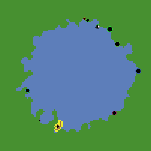 |
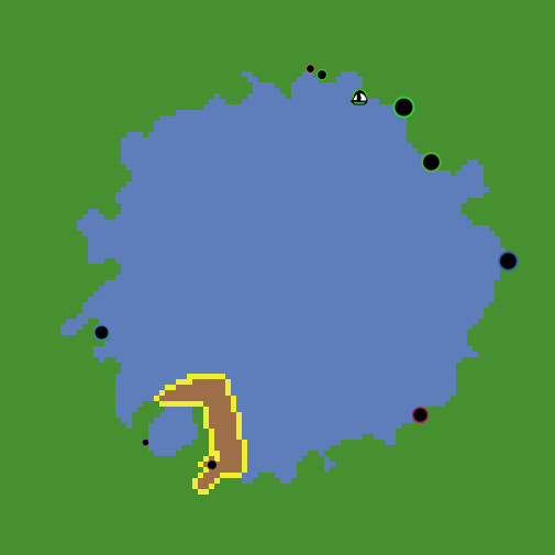 |
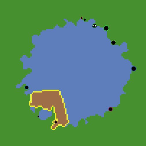 |
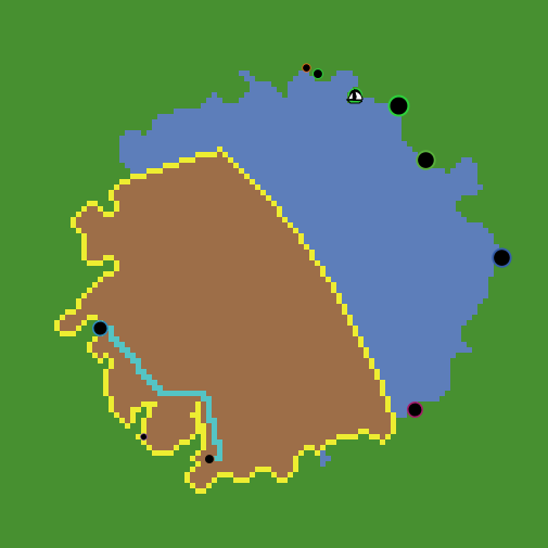 |
Notice how the large difference in path cost between land and water (x50) makes A* avoid drawing a route through land, practically until all adjacent water patches are explored. This will make routes go around peninsulas, for example.
18.4 Finding all routes
Now that we have confirmed the code we just introduced let us implement everything we will need to call A* and keep track of all routes between settlements. Given that A* takes time to compute, we should make everything possible to avoid repeating the calculation of routes.
Our plan is to implement a new procedure, set-routes, that will:
- be called during in
setupafter creating the settlements
- will ask each settlement to find the best routes to every other settlements
- will store the path in a new global variable
routes
This involves:
- creating a new global variable
routes
- creating a new procedure
set-routes
- calling
set-routesinsetup
- asking each settlement to find the best routes to every other settlements
- storing the path in a new global variable
routes
globals [ routes ]

...

to setup

  reset-timer
  clear-all

  ; set the random seed so we can reproduce the same experiment
  random-seed seed

  create-map

  create-coastal-settlements

  set-routes

  create-traders-per-settlement

  update-display

  output-print (word "Set up took " timer " seconds.")

end

...

to set-routes

  set routes [] ; initialize/reset the routes as an empty list

  let settlementsWithoutRoutes settlements ; helper variable to keep track of which settlement already searched for routes

  ask settlements
  [
    let thisSettlement self

    ask other settlementsWithoutRoutes
    [
      let optimalRoute find-a-path ([patch-here] of thisSettlement) ([patch-here] of self) ; find the optimal route to this settlement
      set routes lput optimalRoute routes ; add the optimal route to the end of the routes list

      ; paint route patches in shades of red depending on route frequency
      foreach optimalRoute
      [ ?1 ->
        ask ?1
        [
          ifelse (pcolor = 106 or pcolor = 54) ; if its the first route crossing the patch
          [
            set pcolor 11
          ]
          [
            set pcolor min (list (pcolor + 1) (19)) ; sets a maximum at 19 (the brightest)
          ]
        ]
      ]
    ]

    set settlementsWithoutRoutes other settlementsWithoutRoutes

  ]

end
Running the code as it is will generate the maximum number of routes given the settlements present (e.g., if numberOfSettlements = 10, it will be 45 or 9 + 8 + 7 + 6 + 5 + 4 + 3 + 2 + 1). We store each route as a list of patches, and all routes as a list of routes (routes). These will be globally accessible by all traders in our model.
Notice that it takes a considerable time to calculate all possible routes, and the number of settlements increases this time exponentially. At this point, we should be aware of how to stop NetLogo while still running a long command. Go to Tools > Halt. This might not work if NetLogo interface is unresponsive. Then the only options are to wait or quit or force-quit NetLogo.
18.5 Decision making 🤔
Having the calculation of routes solved, we now must use them to inform the decision of traders. How would you do that?
Before looking at the solution, try to write the code yourself (this is a hard one!):
- Create a new procedure
choose-destinationfor thetraderbreed - The procedure should:
- calculate a “attractiveness” score for each settlement (excluding the base settlement)
- choose the destination settlement with the best attractiveness score
- The attractiveness score should consider:
- the size of the settlement (bigger is more attractive)
- the distance (total path cost) from the base settlement (closer/less costly is more attractive)
Solution:
Let us create a procedure to be called by traders named choose-destination, for which we will need to implement a few “helper” procedures:
traders-own [ base route destination direction lastPosition ]

...

to choose-destination ; ego = trader

  let thisTrader self

  ; get routes connecting the base settlement
  let routesFromBase get-routes-from-settlement [base] of thisTrader

  ; order these routes by benefit/cost ratio
  set routesFromBase sort-by [ [?1 ?2] -> benefit-cost-of-route ?1 > benefit-cost-of-route ?2 ] routesFromBase

  ; print the options available
;  foreach routesFromBase
;  [
;    print "==============================================================="
;    print "route between:"
;    print [who] of get-origin-and-destination ?
;    print "has the benefit-cost ratio of:"
;    print benefit-cost-of-route ?
;  ]
;  print "-x-x-x-x-x-x-x-x-x-x-x-x-x-x-x-x-x-x-x-x-x-x"

  ; select the one with higher benefit/cost ratio
  set route first routesFromBase

  ; mark the most effective route
  foreach route
  [ ?1 ->
    ask ?1 [ set pcolor yellow ]
  ]

  ; get the settlement of destination
  set destination one-of (get-origin-and-destination route) with [who != [who] of ([base] of thisTrader)]

end

...

;;;;;;;;;;;;;;;;;;;;;;;;;;;;;;;;;;;;;;;;;;;;;;;;;;;;;;;;;;;;;;;;;;;;;;;;;;;;;;;;;;;;;;;;;;;;
;;; Get and set routes (helper 'to-report' procedures) ;;;;;;;;;;;;;;;;;;;;;;;;;;;;;;;;;;;;;
;;;;;;;;;;;;;;;;;;;;;;;;;;;;;;;;;;;;;;;;;;;;;;;;;;;;;;;;;;;;;;;;;;;;;;;;;;;;;;;;;;;;;;;;;;;;

to-report get-route [ settlement1 settlement2 ] ; accepts two settlements and returns a route

  ; get routes connecting settlement1
  let routesFromSettlement1 filter
  [ ?1 ->
    ([one-of settlements-here] of first ?1 = settlement1) or
    ([one-of settlements-here] of last ?1 = settlement1)
  ] routes

  ; get the route connecting settlement2 from the previous list
  let routeFromSettlement1ToSettlement2 filter
  [ ?1 ->
    ([one-of settlements-here] of first ?1 = settlement2) or
    ([one-of settlements-here] of last ?1 = settlement2)
  ] routesFromSettlement1

  report first routeFromSettlement1ToSettlement2

end

to-report get-routes-from-settlement [ aSettlement ] ; accepts a settlement and return a list of routes

  report filter
  [ ?1 ->
    ([one-of settlements-here] of first ?1 = aSettlement) or
    ([one-of settlements-here] of last ?1 = aSettlement)
  ] routes

end

to-report get-origin-and-destination [ aRoute ] ; accepts a route and returns a turtle-set with two settlements

  report (turtle-set ([ one-of settlements-here ] of first aRoute) ([one-of settlements-here ] of last aRoute))

end

to-report benefit-cost-of-route [ aRoute ] ; accepts a route and returns a number (the benefit/cost ratio of the route)

  let cost 0

  foreach aRoute ; for every patch in the given route
  [ ?1 ->
    set cost cost + [pathCost] of ?1
  ]

  let originAndDestination get-origin-and-destination aRoute
  let benefit 0
  ask originAndDestination [ set benefit benefit + sizeLevel ] ; the benefit is the sum of the sizeLevel of the two settlements

  report benefit / cost

end
Notice that get-route is only helpful for debugging and querying the information in routes.
To inform the traders’ decisions, we specify a very simple calculation of the potential gain of a route (sum of sizeLevel of origin and destination) and calculate a ratio between the benefit and cost of routes. Traders will then compare these ratios for all possible routes from its base settlement and choose the one with the highest value.
18.6 Movement 🤔
Once a destination is decided, traders must move towards it and then, once there, start the return trip. Are you up to this challenge?
Before looking at the solution, try to write the code yourself (this is VERY hard!): - Create a new procedure move-to-destination for the trader breed - The procedure should: - move the trader along the selected route towards the destination settlement (or back) - check if the trader is at the destination or base settlement and choose the right direction - check if in a patch centre (round coordinates) to move to the next patch in the route - move progressivelly towards the next patch in the route (not teleporting) - speed should be dependent on the pathCost of the patch-here
Things to consider: - How to keep track of the direction of movement? - How to keep track of the progress of movement? - How to check if the trader is at the destination or base settlement? - How to check if the trader is in a patch centre? - How to move progressivelly one patch centre to another? - How to make the speed dependent on the pathCost of the patch-here?
Solution:
We implement this behaviour assuming that movement must go through each patch centre in the route and that traders move at a maximum speed of 1 / [pathCost] of patch-here, meaning they will be delayed in proportion to the local value of pathCost.
to move-to-destination ; ego = trader

  ; update lastPosition if in a patch center
  if ((xcor = [pxcor] of patch-here) and (ycor = [pycor] of patch-here))
  [
    set lastPosition patch-here
  ]
  ; find where in the route list is the trader
  let currentPosition position lastPosition route

  ; set direction if in a settlement
  ifelse (currentPosition = 0) ; in the first extreme of the route list
  [
    set direction 1 ; move in the route list towards larger index numbers
  ]
  [
    if (currentPosition = (length route - 1)) ; in the last extreme of the route list
    [
      set direction -1 ; move in the route list towards smaller index numbers
    ]
  ]
  ; else the trader is in route to either the base or the destination

  ; move through the route following direction
  let targetPatch item (currentPosition + direction) route
  ;move-to targetPatch ; constant travel time (1 patch per tick)
  facexy ([pxcor] of targetPatch) ([pycor] of targetPatch)
  forward min (
    list
    (1 / [pathCost] of patch-here) ; the maximum distance in a tick in the current patch
    (distancexy ([pxcor] of targetPatch) ([pycor] of targetPatch)) ; the distance to the target patch
    )

end
We wrap up this development step by finally implementing our preliminary model cycle, ordering the behaviour of traders within the conventional go procedure:
to go

  ask traders
  [
    if (patch-here = [patch-here] of base) ; update the destination whenever in the base settlement
    [
      choose-destination
    ]
    move-to-destination
  ]

end
As we specified in our conceptual model, traders will choose a destination whenever they are at their base and move towards their current destination.
18.7 Enhancing visualisation
To help visualise routes, implement the following version of update-display, call it at the end of setup, and add two switches, showRoutes and showActiveRoutes to the interface:
to setup
clear-all
reset-ticks
; set the random seed so we can reproduce the same experiment
random-seed seed
create-map
create-coastal-settlements
set-routes
create-traders-per-settlement
update-display
end
...
to update-display
paint-routes
paint-active-routes
; scale the size of settlements according to their dynamic free-scaled sizeLevel
let maxSettlementSize max [sizeLevel] of settlements
ask settlements
[
set hidden? not showSettlements
set size 1 + (sizeLevel / maxSettlementSize) * 9
]
end
to paint-routes
; resets route patches to the terrain color
foreach routes
[ ?1 ->
let aRoute ?1
foreach aRoute
[ ??1 ->
ask ??1 [ paint-terrain ]
]
]
; paint route patches in shades of red depending on route frequency
foreach routes
[ ?1 ->
let aRoute ?1
foreach aRoute
[ ??1 ->
ask ??1
[
if (showRoutes)
[
ifelse (pcolor < 11 or pcolor > 19) ; if its the first route crossing the patch
[
set pcolor 11
]
[
set pcolor min (list (pcolor + 1) (19)) ; sets a maximum at 19 (the brightest)
]
]
]
]
]
end
to paint-active-routes
ask traders
[
foreach route
[ ?1 ->
ask ?1
[
ifelse (showActiveRoutes)
[
set pcolor yellow
]
[
if (not showRoutes) ; if not displaying all routes
[
; resets to the patch terrain color
paint-terrain
]
]
]
]
]
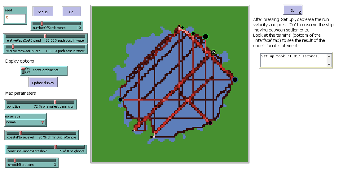
end18.8 Testing agent behaviour
As a temporary “hack”, replace the code create-traders-per-settlement with the following:
to create-traders-per-settlement

  ; For now, we create only one trader to better control its behaviour
  ask one-of settlements
  [
    let thisSettlement self

    hatch-traders 1
    [
      set base thisSettlement

      set shape "sailboat side" ; import this shape from the library (Tools > Shape editor > import from library)
      set color [color] of base
      set size 3
    ]
  ]

; the previous code for creating traders can be commented out
; by adding ';' at the beggining of each line, or
; by selecting several lines and either selecting 'Edit > Comment' or pressing 'ctrl + ;'.
;  ask settlements
;  [
;    let thisSettlement self ; to avoid the confusion of nested agent queries
;    hatch-traders round sizeLevel ; use the sizeLevel variable as the number of traders based in the settlement
;    [
;      set base thisSettlement
;
;      ; give meaningful display related to base
;      set shape "sailboat side" ; import this shape from the library (Tools > Shape editor > import from library)
;      set color [color] of base
;      set size 3
;
;      ; place it somewhere in the pond, randomly for now (if not, the command "hatch-breed" will place them in the same patch of the settlement)
;      move-to one-of patches with [isLand = false]
;    ]
;  ]

end
Reduce numberOfSettlements (e.g. 10) and run setup again. Run go repeatedly to observe the behaviour of the loner trader.
18.9 Checking the milestone File (step 7)
Pond Trade step 7